|
|
|
AutoDesSys products: |
|||||
|
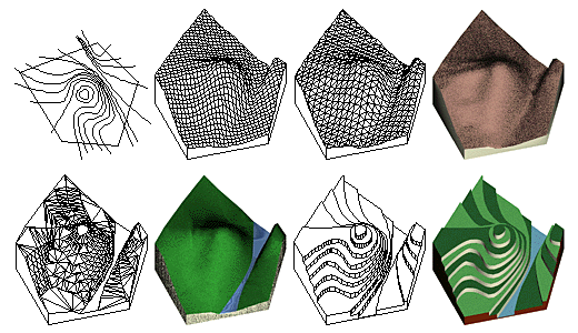
Above, top to bottom, left to right: Contour lines and site from which
meshed, triangulated meshed, triangulated contour, and stepped terrain
models are generated.
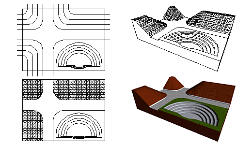
By combining the four types of terrain modeling available in form•Z, and possibly other operations of the program, terrain models can easily incorporate additional features such as rivers, lakes, flat areas, and roads, as illustrated below.
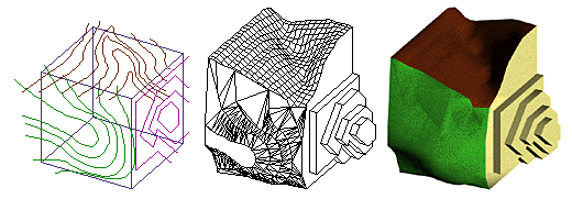
Especially noteworthy is form·Z's unique ability to generate terrain models on the surfaces of other previously created 3D objects. These surfaces may have any arbitrary orientation in 3D space. This ability makes the terrain modeling tool useful for the articulation of 3D forms in areas other than landform modeling.
|
|
|
|||


